Maps
Which National Park is the Closest to Where You Live?
If you’ve ever wondered which of the sixty-three National Parks that are scattered throughout the United States is closest to you, then wonder no more! We came across this map that breaks the country down into 63 regions, to show which National Park is the closest for every area in the United States. While we originally found this map visual shared in the r/dataisbeautiful subreddit, it was originally created by esri using the Thiessen (Voronoi) polygon tool.
Click below to zoom
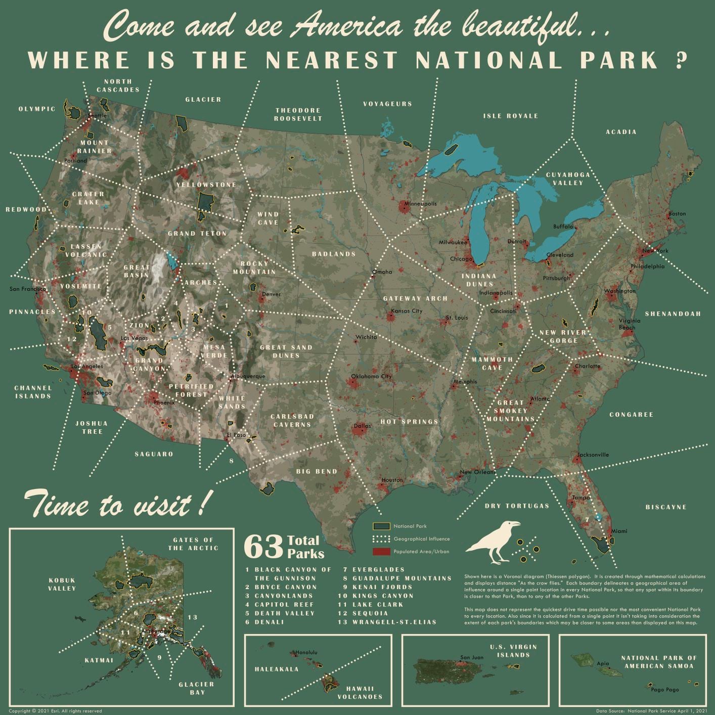
If you’re also picking up vintage vibes from this map, that’s because it was designed to be reminiscent of vintage National Park posters. An excellent design choice in our opinion! How did they determine which National Park was the closest to every area in the U.S.? The distance in each boundary is displayed “as the crow flies” so any spot within each National Park’s boundary is closer to that park than to any other. Although these boundaries do not take into account the shortest drive time or the most convenient National Park to each location. Looking at the map you can see that there are a lot more National Park options on the western part of the country than on the eastern. This is due to the west having a lot more open land available when the National Park Service began in 1916, while the eastern side of the country had a lot more of its land already developed at that time. Which of the sixty-three National Parks is the closest to you!?